Today we headed up Hwy 59 to ride Little Creek. Just the drive alone was quite the adventure. Last time we had a GPS that had all the dirt roads so the 6 mile off road trip was a piece of cake. This time I borrowed my sister in law’s and discovered only too late that it only displayed paved streets and it was very poor at that. How Magellan discovered anything is beyond me. I am a Gamin boy, through and through. Fortunately we had an odometer and decent directions. Only one wrong turn but we got there safe and sound.
Little Creek is slick rock and lots of single track. While it is not a hill ride, there is still plenty of climbing and descending, usually in short and very steep bursts. Some riders say it is similar to Gooseberry but I think it is far more challenging, navigationally speaking. While Gooseberry has white and green dots painted on the rocks to follow, none of that exists here. It is all rock cairns (towers) that help guide you to the trail or over the expansive slick rock. It becomes a giant game of hide and seek. First the trail is easy to find and then it dumps you out onto the pink slick rock. Think of slick rock the size or area of a Wal-Mart parking lot. Somewhere on the other side there is a trail into the trees, masterfully hidden. If you do not find the next rock tower, you will have a heck of a time finding the trail again.
The cool part is there is no real trail on the slick rock. You are responsible to navigate to the next rock marker via your own line. Sometimes there are very obvious lines and other times you have to search for the best line. Lots of surprise drop offs and the such. Some areas are for flying while others will kill you. And I really mean that. Much of the trail skirts a 100 – 200 foot vertical cliff. No room for mistakes.
The stats - 15 miles and 1250 ft of climbing
Attachment:
File comment: Lots and lots and lots of slick rock. Most of it pink.
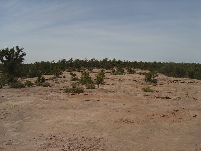
Pink rock.jpg [ 154.62 KiB | Viewed 8304 times ]
Pink rock.jpg [ 154.62 KiB | Viewed 8304 times ]
So, again here are the pics. As they say, a picture is worth a thousand words.
| Attachments: |
|
File comment: Moving right to left - The trail over the rock bridge, onto a large suspended boulder and over smaller rock bridge. rock bridge.jpg [ 281.53 KiB | Viewed 8308 times ] |
|
File comment: If you misjudge the bridge, you get to the golf course really, really fast. bridge penalty.jpg [ 268.15 KiB | Viewed 8309 times ] |
|
File comment: Don't miss your turn. Death would be imminent. failure would suck.jpg [ 173.8 KiB | Viewed 8311 times ] |
|
File comment: Typical s/t through the Junipers trail.jpg [ 289 KiB | Viewed 8298 times ] |
|
File comment: Follow the rock towers for the trail. This one leads up and to the right. See it? This one was easy. Hide and seek.jpg [ 196.08 KiB | Viewed 8302 times ] |