I didn’t know just how dire the situation was with a fellow rider until I called him early last week. It wasn’t but just a few months ago, he and his wife completed the 2010 Leadville 100 race and he then followed it up with the Ride of the Immortals just a few weeks later. Yet now he was having trouble getting in even a moderate ride and had delayed in seeing a doctor about his symptoms. But he needed serious help fast, so I dropped all my plans for the weekend we rushed off to the Scottsdale Mayo Clinic. I was all too familiar with the required procedure. Unfortunately they don’t welcome walk-ins without doctor referrals and advance appointments. Already having helped two other fellow riders with similar symptoms, his situation called for drastic measures but wasn’t without risk.
It’s been nearly a year since I last rode w/ Jeff^d. The three times we’ve gotten together were to complete monster rides on new routes. So I knew exactly what was needed to for him to begin the recovery process of local ride depression and low mileage counts. I was also just coming off a month-long rest and recovery period from a riding knee stress injury. While Southern California was receiving rain Saturday morning, we awoke to fresh Arizona desert air after having thrown our sleeping bags & pillows on the ground and fallen asleep from the late night drive. Then it was off to Scottsdale, bordered on the north side by the McDowell Sonoran Preserve. This is separate from the popular McDowell Mountain Regional Park that is directly adjacent to the east with dedicated MTB competitive loops. The two couldn’t be more opposite with the Preserve offering a number of serious climbing opportunities that is only eclipsed by the White Tank and Phoenix South Mountain Preserve in terms of technical climbs & descents. A fellow AZ rider sent me a link about a Bypass route nearly two years ago and was the first thing that came to mind to help out Jeff.
The morning’s pre-ride ritual was a bit different as we stopped by a local farmer’s market and loaded up on fresh, hot tamales for breakfast and our mid-ride lunch. Conditions were nearly perfect once we hit the trail: low 80’s and breezy.

This was also Jeff’s first ride in Arizona. For anyone who hasn’t ridden there, their trails don’t play by California rules. For starters, nearly every hiker was friendly and courtesies were exchanged both ways. Most trails aren’t nicely sanitized and unnecessarily widened and equestrian users don’t seem to mind it a bit.

The McDowell Sonoran Preserve doesn’t seem to see nearly the traffic of South Mountain Preserve does. So it’s a lot more similar to White Tanks in the sense that the tread isn’t well worn and has quite a bit of loose rock, especially on the Wingate section.

Arizona mileage and climbing numbers also don’t equate to the rule of thumb expected by SoCal riders. It takes us an abysmal 2 hours to climb the 1,500’ over 5 miles to Windgate Pass.


As we take a brief break at Windgate Pass, we’re already talking of modifying our route as to not come back down it in the dark due to the loose rock. Barely 1/6th into this ride, we continue on.


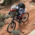
Next up, Bell Pass (on the right).

We were happy to find this segment slightly more worn in.


Great view from Bell Pass overlooking Scottsdale

The reward for all this effort is a sweet, switchbacked descent to pick up our next trail.


Traversing east along the foothills via Paradise and Lost Dog Wash trails, the next climb is up Sunset.

But the demoralizing part is finding a false pass. Once you reach it, you’re just rewarded with more climbing ahead. Jeff starts to reconsider our route based on remaining daylight, but I’m the doctor on this ride and am not willing to put up with a 7 mile road ride back to the car.

Sunset Pass provides another great view.

Another great switchback descent.


By now we’re 5 ½ hours into this ride, having covered a paltry 18 miles. Both Jeff and I are dangerously low on water in our 3L packs. He mentions he hopes to find a water fountain at the Sunset trailhead and I can only hope he was right. Not only are we rewarded with our water fountain, I can’t recall ever having come across a refrigerated one at that. Only in Scottsdale.

Cold water fills our hydration packs and I cool off by rinsing the sweat and heat off my head. Now refreshed, we head up through the neighborhood and pickup a double track that leads us to Ring Tail trail.

At the end where it turns down towards the Fountain Hills neighborhood, we spot the Sonoran Trail.

This trail was built for hiking, so several switchbacks are too tight to negotiate with the bike, but it provides some great singletrack that isn’t to be missed as it connects over to Dixie Mine. As the mountains cast shadows across the north facing slopes, we’re able to keep up our pace, no longer in direct sunlight. Not much in the way of photo opportunities after this point as we climb up Prospector. As darkness settles in, we end up missing the sunset at Bell Pass by 43 minutes. But Jeff and I are used to endings like this and just soak it in.

The night time descent with the city lights below added that extra special finish to this epic ride. McDowell Sonoran slots into 3rd place behind South Mountain and White Tanks in the Phoenix area. I’m also happy to report Jeff is feeling much better after today’s procedure and is well on his way to recovering fully from his prior state of health. The following day would be some light & fun physical therapy to cap off the weekend.
Type: Desert mountains cross-country
Highest/Lowest elevations: 3,211’/1,609’
Distance: 31.0 mi
Total Ascent: 6,061’
Total Descent: 6,238’
Total Time: 8 hrs 21 min


Postlogue:
The original quadruple bypass route was started in 2007 and crosses Wingate-Bell-Sunset-Wingate Passes totaling some 33 miles and 6,900’ of climbing. Both our GPSs showed between 6,100-6,400’ of climbing for our modified route but should only be about a hundred or so less than the original route. Annual ride threads can be found in the Arizona MTBR forum and suggest 6.5 - 8 hours for mortals to complete. I’d estimate we went through 4-4.5 liters of water for our ride in mid-80 temps. Dale Wiggins publishes a map of the original route (
http://singletrack.us/gallery/displayim ... fullsize=1) but hasn’t been updated with the Sonoran Trail between mileages 20.5 and 22.5 that was opened in Sep 2009.